FLOODS AND THE GREAT DRAINAGE SCHEME
Richard Austin
Without any warning at 7pm on 10th November 1810 the sea banks from Wainfleet to Fosdyke were overwhelmed by a North Sea storm surge. Almost the whole of the Borough of Boston was flooded. This event prompted large investment in higher sea defences and further expenditure on drains, dykes and pumps. The cost of maintaining these is now paid for by the drainage rates levied on every house and business in the Borough.
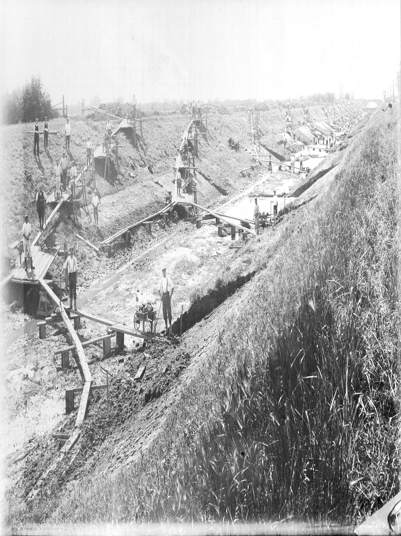
Cleansing the South Forty Foot at High Bridge, Wyberton in 1910.
.jpg)
The South Forty Foot taken at Wyberton High Bridge in 2019.
Surges in the North Sea can occur when a very high tide, pulled up by a full moon, coincides with a north westerly gale. There were significant surges in 1953, 1978 and 2013 that caused localised flooding however the defences now in place have kept the Borough largely secure. The £102m barrier in the Haven near the port is designed to give Boston a further level of protection. In addition parts of the Borough are at risk from inland water at times of high rainfall and heavy snow fall. In recent times this happened in 1947, 1977 and 1981.
In the 11th and 12th-centuries monks made some of the first efforts to protect the area by building sea banks often misnamed ‘Roman’ banks. In 1500 a sluice was built across the Haven near to the town bridge to control the Witham, and in 1636 the first South Forty Foot Drain was dug. This was fiercely opposed by those whose livelihood of fishing, wildfowling and reed cutting was threatened. They destroyed the outfall into the Haven by burning the wooden sluice gates. It is thought that is why it became known as the ‘Black Sluice’. Later, in 1658 the Skirbeck River was deepened and straightened to form the Maud Foster drain. In 1720 the North Forty Foot Drain was dug from Chapel Hill to try to improve the drainage of Holland Fen. However it was not until 1766 that there was significant protection for the low lying land between Boston and Lincoln when the Grand Sluice was built and the Witham up to Lincoln was ‘canalised’.
.JPG)
Map showing the principal drains of the Borough of Boston. (Steve Johnson)
A big scheme to reopen and extend the South Forty Foot Drain was began in 1765. Scoop-wheels powered by windmills were built to lift water from the lowest areas into this new watercourse. Steam and now electric pumps have replaced them.
The Hobhole drain was begun in 1806 to drain the Fens to the north and east of Boston with Sir Joseph Banks as one of the prime movers. Peat shrinkage caused the drainage of these Fens to worsen, so in 1867 a large steam pump was installed at Lade Bank. The ornate chimney is still a feature in the landscape. In 1935 the Black Sluice and the Witham Fourth Internal Drainage Boards were established to levy the drainage rates and also to maintain and improve the system. Today they work in conjunction with the Environment Agency who are responsible for the sea defences and the major river network.